New data - Green Belt statistics
Ministry of Housing, Communities and Local Government (MHCLG) Green Belt statistics have been added to LG Inform for the first time. 37.4% of land in England is currently protected, including land designated as Green Belt. 12.6% of total land in England is designated as Green Belt.
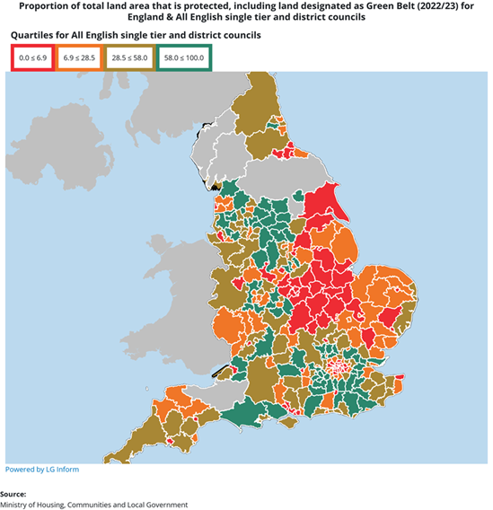
In England for 2022/23, the area of land designated as Green Belt was 1,638,420 hectares up from 1,637,562 hectares in 2021/22. The area with the highest proportion of Green Belt land was Bromsgrove at 88.9%.
The proportion of total land area designated as Built-up areas in England is 11.2%. Islington and City of London have the highest proportion at 99.2%, with West Devon the lowest at 1.3%.